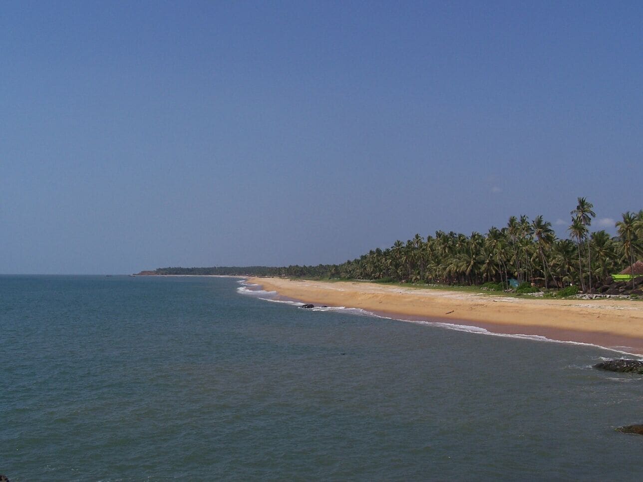
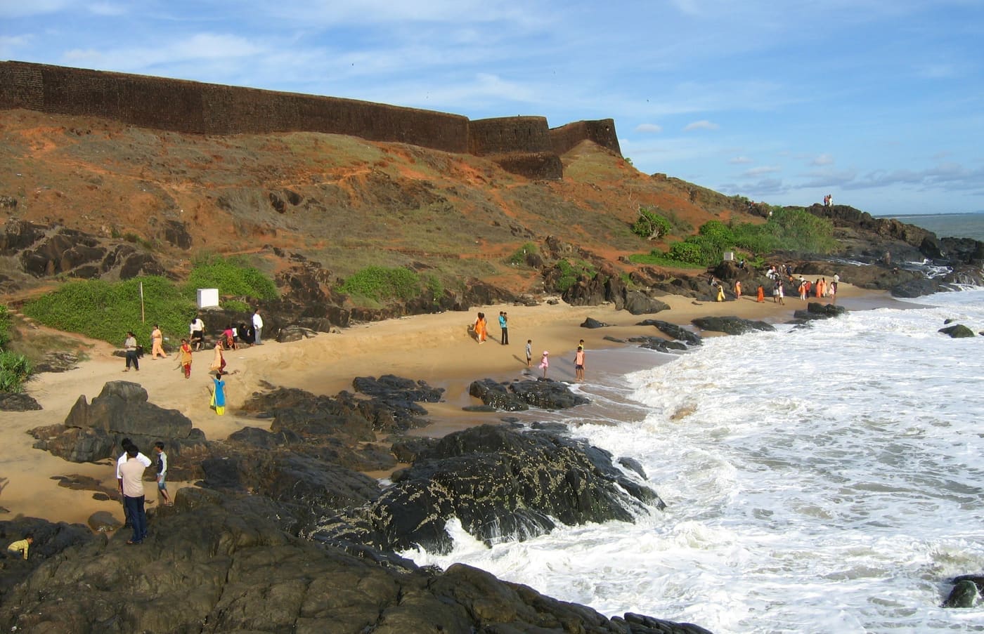
Where the twin rivers Chandragiri and Payaswini spill into the Arabian Sea beneath a brooding laterite fort, the water goes glass-still, the palms lean in close, and the sunset turns the whole estuary to beaten gold.
The story of Chandragiri backwaters
The Chandragiri Backwaters unfurl at the southern edge of Bekal, in Kerala’s northernmost district of Kasaragod, where a broad tidal river slides quietly out to meet the Arabian Sea. This is Kerala’s far-north answer to the famous backwaters of the south — quieter, wilder and far less trodden, a place where a boat can drift for an hour without passing another traveller. The estuary is fed by two rivers that many locals treat as one: the Payaswini, which also carries the older, poetic name Chandragiri, winding down from the Western Ghats through emerald coconut country before opening into this wide, mirror-flat mouth.
Watching over it all from a green bluff stands Chandragiri Fort, a squat seventeenth-century citadel of red laterite that gives the backwaters both their name and their sense of history. From the fort’s ramparts, some fifty metres above the water, the view is the stuff of postcards — the river threading through banks of feathered palm, sandbars glinting pale in the shallows, and, far out, the point where fresh water surrenders to the sea in a long silver seam. Photographers climb up for that panorama; almost everyone stays for the sunset.
Down at water level, the backwaters are best met by boat. From near the Chandragiri bridge, small operators and local fishermen push off in country craft, speedboats and the occasional houseboat, threading between low green islands, hidden palm groves and quiet fishing hamlets. A ride here is unhurried and intimate — kingfishers stitching low over the water, cormorants drying their wings on stray poles, the smell of river mud and salt on the breeze, and the fort keeping its silent watch above.
The lagoon-like calm is the region’s signature. Sheltered by its sandbars and lined with coconut and mangrove, the estuary rarely churns; even at midday the surface holds the sky. Village life leans right up to the edge — nets drying on the banks, canoes drawn up in the shade, the toddy-palm silhouettes that define the north-Malabar coast. It is scenery built for slowness, and for the long, coppery light of late afternoon.
It is the sunset that has made Chandragiri a local favourite. As the sun sinks over the Arabian Sea, the whole river-mouth catches fire — orange, then rose, then a deep bruised violet — and the fort walls glow warm above the darkening water. Many watch it from the ramparts themselves, or from the grounds of the old Kizhur Siva Temple nearby, long a favourite vantage for the evening spectacle.
And all of this sits barely a handful of kilometres from Bekal Fort, Kerala’s largest and most photographed sea fort. That closeness makes the Chandragiri Backwaters an easy, rewarding half-day escape from the Bekal–Kasaragod coast — a pairing of hilltop history, wide estuary and unhurried boating that still feels, wonderfully, like a place the crowds have not quite found.
Legend & myth
Local tradition offers a romantic explanation for the name. Chandragiri joins chandra, the moon, with giri, a hill — literally the moon-hill — and the river-mouth is fondly said to have been named for a hill that shines pale and luminous as the moon, or in honour of Chandra, the moon god himself. A second, widely-repeated tradition ties the name to the Mauryan emperor Chandragupta Maurya, who by legend journeyed south in his final years; the river is popularly held to carry his name down the centuries.
These are folk traditions rather than settled history, and they sit alongside the river’s better-documented role as a frontier. For generations the Chandragiri was regarded as the boundary between the Malayalam-speaking Kolathunad country to its south and the Tulu-speaking lands to its north — a threshold in language, culture and old kingdoms as much as a line on the water. It is a story worth carrying gently: attribute it as local lore, not fact.
History
The commanding presence over the backwaters is Chandragiri Fort, generally dated to the seventeenth century and attributed to Shivappa Nayaka of the Ikkeri (Keladi/Bednore) line of Nayakas. As the Vijayanagara Empire fractured, the Keladi Nayakas pushed their authority into this coast, and Shivappa Nayaka is credited with raising or refortifying a ring of forts across the region to secure it — Chandragiri among them, planted deliberately at the meeting of river and sea.
Its siting was strategic rather than scenic. The fort occupies high ground of some seven acres above the estuary, girded by thick laterite walls and studded with round bastions pierced for cannon, giving its defenders a full sweep of the sea approaches and the river mouth alike. Weathered barracks, ruined structures and traces of an underground passage still survive within the walls — the working bones of a coastal stronghold rather than a palace.
The Chandragiri river itself long carried a significance larger than any single fort. It is remembered as the traditional frontier between the Kolathunad kingdom to its south and the Tulu Nadu country to its north — a cultural and linguistic divide between the Malayalam and Tulu worlds that still lingers in the region’s dialects and customs. Control of a fort straddling that boundary, beside a river mouth open to the sea, carried obvious weight.
Like much of the Malabar coast, the fort changed hands as regional power shifted. After the Nayakas it is recorded as passing to Hyder Ali of Mysore and, in time, into British possession, following the broader arc by which Mysore’s and then colonial authority absorbed the small coastal polities of the north. Through these turns the citadel gradually lost its military purpose and settled into the ruin visitors see today.
Now the fort and its backwaters are a heritage-and-nature draw rather than a defensive post, promoted alongside neighbouring Bekal as part of Kasaragod’s coastal circuit. The ramparts serve sightseers and sunset-watchers; the estuary below carries small tourist boats where warships and trading craft were once watched for. What endures is the setting the Nayakas prized — a red fort on a green hill above a wide, quiet meeting of rivers and sea.
Why visit
One of the finest sunsets in north Kerala, watched over the Arabian Sea with the river-mouth ablaze below the fort.
Unhurried backwater boat rides through palm-fringed islands, hidden groves and quiet fishing hamlets, far from the southern crowds.
A genuine seventeenth-century laterite fort, attributed to Shivappa Nayaka, with bastions, ruins and postcard views from its ramparts.
The dramatic confluence where the twin Chandragiri and Payaswini waters merge with the sea — a photographer’s and nature-lover’s delight.
Serene, lagoon-like calm framed by coconut palms, sandbars and birdlife — kingfishers, cormorants and egrets along the banks.
An easy pairing with mighty Bekal Fort just a few kilometres away, making a rewarding half-day of history, water and views.