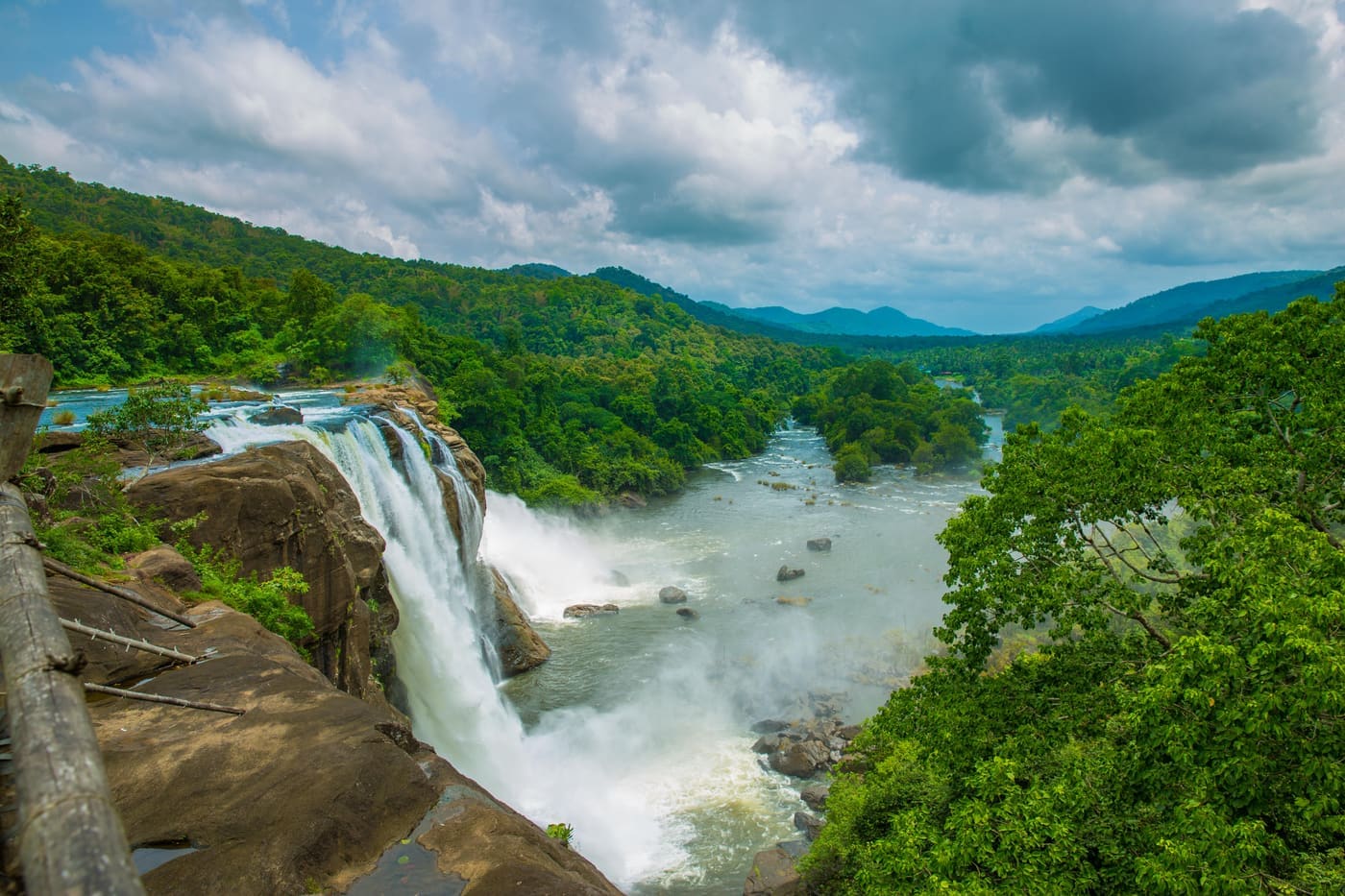
Vazhachal Falls

A forest waterfall on the Chalakudy river just above Athirappilly, on the Sholayar forest road — often visited on the same Kochi day trip. This waterfall guide is organized from Thattekkad in Ernakulam district, with practical planning for routes, timing, nearby stays, food, operators and direct local inventory. Use it to compare what to see, how long to spend, when to go and which verified stays, local guides, jeep or taxi operators, food stops, permits and safety-aware activity providers should be verified around Vazhachal Falls.

Vazhachal Falls, Thattekkad
Practical guide

Plan Vazhachal Falls

Typewaterfall
Nearest baseThattekkad
Best timePost-monsoon is usually strongest
Time needed1 to 3 hours
EntryA modest entry ticket typically applies, usually as part of the combined Athirappilly–Vazhachal pass, with separate charges commonly levied for cameras and parking; amounts vary over time (indicative — confirm locally).
Nearest town/baseThattekkad
DistrictErnakulam
Place typewaterfall
Time needed1 to 3 hours.

A forest waterfall on the Chalakudy river just above Athirappilly, on the Sholayar forest road — often visited on the same Kochi day trip. This waterfall guide is organized from Thattekkad in Ernakulam district, with practical planning for routes, timing, nearby stays, food, operators and direct local inventory. Use it to compare what to see, how long to spend, when to go and which verified stays, local guides, jeep or taxi operators, food stops, permits and safety-aware activity providers should be verified around Vazhachal Falls.

Vazhachal Falls belongs under Thattekkad, one of the practical travel bases in Ernakulam district. Use Thattekkad for stays, food, local transport and operators, then plan this place as a focused stop rather than an isolated pin.

The story

Vazhachal Falls is the quieter, wilder sibling of famous Athirappilly, a broad sweep of the Chalakudy River breaking into white rapids over black rock at the very edge of the Vazhachal Forest Division — one of the last riverine rainforests in the southern Western Ghats, home to all four of India's peninsular hornbills and to the Kadar, an indigenous community whose stewardship has kept this stretch of river alive.

The story of Vazhachal Falls

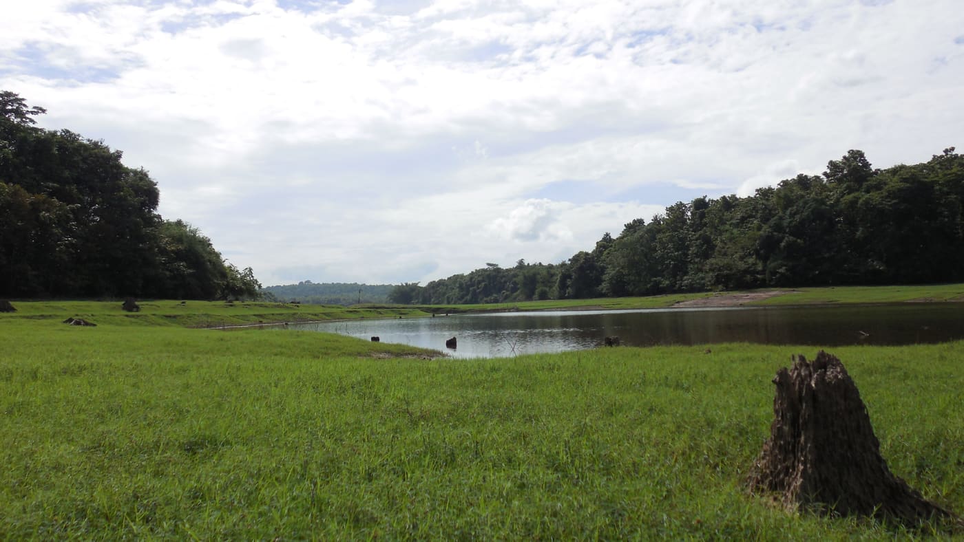
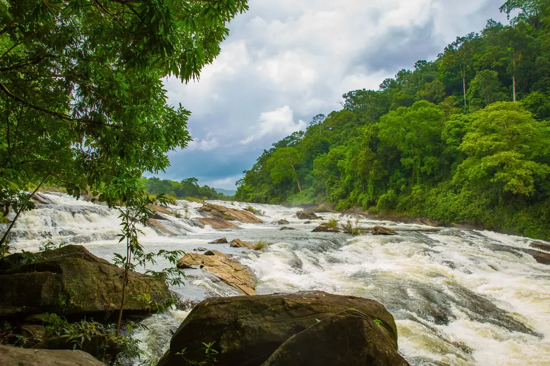
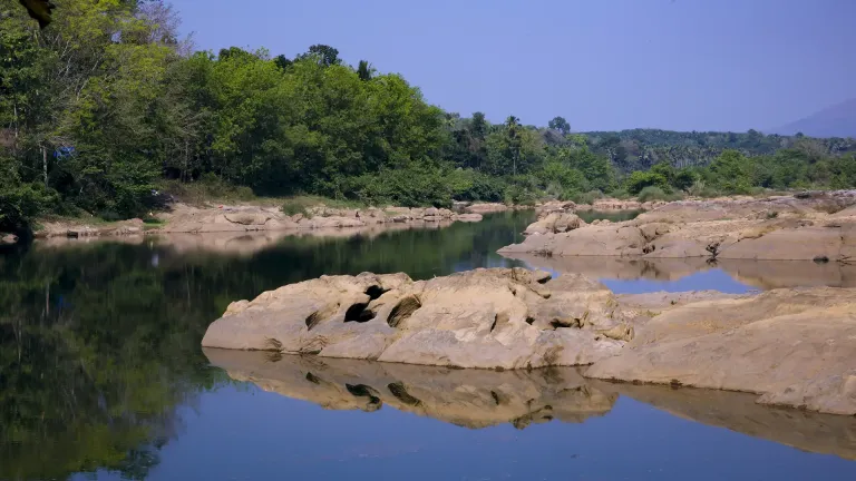
Where Athirappilly drops in one thunderous plunge, Vazhachal spreads out and races. Here the Chalakudy River widens across a long shelf of dark, water-sculpted rock and shatters into a fan of cascading rapids and low cascades rather than a single tall fall. In the monsoon the whole width turns into a roaring sheet of foam; in the drier months it settles into braided channels sliding between smooth boulders, with the forest crowding right down to the water's edge.

The setting is the real spectacle. Vazhachal sits at the threshold of the Vazhachal Forest Division, a rare low-elevation riverine forest that forms part of the Anamalai landscape in the Western Ghats — a UNESCO-recognised global biodiversity hotspot. The Chalakudy is one of the most species-rich rivers in Kerala, and the ribbon of forest along it is a corridor for elephants, a refuge for the endangered lion-tailed macaque and Malabar giant squirrel, and, most famously, a stronghold for hornbills.

This is one of the very few places in the entire Western Ghats where all four of the region's hornbill species are found together: the magnificent great hornbill, the Malabar pied hornbill, the Malabar grey hornbill and the Indian grey hornbill. The great hornbill — locally the Malamuzhakki Vezhambal, roughly the one whose deep call resounds through the mountains — needs tall old riverside trees with natural cavities to nest, which is exactly what this stretch of the Chalakudy still provides (indicative — confirm locally).

The forest here is not empty wilderness; it is the ancestral home of the Kadar, a small indigenous community who have lived along the Chalakudy for generations. Traditionally gatherers of forest honey, medicinal plants, fruit and fish, the Kadar hold an intimate, working knowledge of the river and its trees. In recent decades members of the community have turned that knowledge to conservation — helping monitor and protect hornbill nests, and largely ending the earlier practice of hunting the birds (indicative — confirm locally).

That guardianship has a hard-won political edge. Under India's Forest Rights Act of 2006 the Kadar settlements have secured Community Forest Rights over a long stretch of this landscape, giving them a formal say over what happens on their territory. Figures such as Geetha Vazhachal — described as the first woman moopathi, or chieftain, of the Kadar — have become well-known voices for the community and for the river, linking indigenous rights with the defence of the forest itself (indicative — confirm locally).

For the visitor, all of this gives Vazhachal a different mood from its crowded neighbour. It rewards those who slow down: the shine of spray on rock, the possibility of a hornbill's heavy wingbeats overhead, the sense of standing at the edge of a forest that people have fought, successfully so far, to keep whole.

History

Vazhachal has long been known simply as a beautiful bend of the Chalakudy River on the old route toward the high ranges and the Tamil Nadu border, close enough to Athirappilly that the two are almost always visited together. It lies within the Vazhachal Forest Division, managed by the Kerala Forest Department, which controls access and runs the shared entry-pass system with Athirappilly (indicative — confirm locally).

The stretch's modern reputation is bound up with conservation science. The Chalakudy River basin and the Vazhachal forests have been recognised for exceptional ecological value — the area has been identified as an Important Bird Area for its hornbill populations, and the riverine forest is prized as one of the few of its kind left in Kerala (indicative — confirm locally).

From the mid-1990s onward, Vazhachal became the centre of one of Kerala's longest-running environmental controversies: the proposed Athirappilly hydroelectric project. First put forward by the Kerala State Electricity Board around 1996, the plan envisaged a dam on the Chalakudy in the Vazhachal Forest Division — reported at roughly 23 metres high with a 163-megawatt capacity — to generate power (indicative — confirm locally).

The project drew sustained opposition on two intertwined grounds. Ecologically, critics warned it would submerge biodiverse riverine forest, threaten the hornbills' nesting habitat and disrupt an elephant corridor, and could diminish the flow that makes both Vazhachal and Athirappilly what they are. On rights grounds, the Kadar community opposed it, pointing out that many families would be displaced and that the community had already been pushed downstream by earlier hydro projects; under the Forest Rights Act their Community Forest Rights gave the opposition legal weight (indicative — confirm locally).

After decades of protests, legal challenges and studies, the Kerala government at one point announced it was shelving the project — though proposals to revive it, at times reframed around tourism, have periodically resurfaced. Because the situation has shifted over the years and remains contested, treat any specific status as provisional and confirm the current position locally (indicative — confirm locally).

Why visit

It is a genuine Western Ghats rainforest riverscape without the full crush of Athirappilly — the same magnificent Chalakudy River, but broader, wilder and framed by dense forest that comes right down to the rocks.

It is one of the only spots in the Western Ghats where all four peninsular hornbill species occur, so patient birdwatchers have a real chance of hearing or glimpsing the great hornbill and its relatives around the riverside forest (sightings never guaranteed — indicative, confirm locally).

The falls pair naturally with Athirappilly just a few kilometres away, letting you combine the region's dramatic single plunge with Vazhachal's long, cascading rapids in a single outing.

In full monsoon the river is at its most powerful and photogenic, a wide roaring sheet of white water against black rock and green forest — one of the great sights of central Kerala.

It carries a rare and important story: a living indigenous community, the Kadar, whose stewardship and rights struggle to protect this forest and its hornbills make Vazhachal as much a place of conservation history as of scenery.

Because it is less commercialised, it suits travellers who want quiet, nature and a slower pace over selfie-crowds — a place to sit by the water and watch the forest rather than tick a box.
Visiting

Vazhachal Falls — at a glance

TimingsGenerally open through daytime hours, with access controlled by the Kerala Forest Department under the shared Athirappilly–Vazhachal entry system; exact opening and closing times can change seasonally (indicative — confirm locally).
Best timeMonsoon and immediately after (broadly June to September, into the following months) for the most powerful flow; the post-monsoon and winter months (roughly October to February) for greener, calmer and more comfortable visiting. Mornings are best for birdwatching and smaller crowds (indicative — confirm locally).

Entry: A modest entry ticket typically applies, usually as part of the combined Athirappilly–Vazhachal pass, with separate charges commonly levied for cameras and parking; amounts vary over time (indicative — confirm locally).

Dress code: No formal dress code; wear comfortable clothes and sturdy, non-slip footwear for wet, slippery rock, and carry a rain layer in the monsoon. Dress modestly as this is a forest and tribal-homeland area (indicative — confirm locally).

Festivals: Vazhachal is a natural and forest site rather than a temple, so it has no associated religious festival; it is busiest during the monsoon spectacle and on holidays and long weekends (indicative — confirm locally).

Photography: Photography is popular and usually permitted, though a camera fee may apply and drone use is typically restricted in this forest zone; protect gear from heavy spray and never step past barriers for a shot (indicative — confirm locally).

Getting here

How to reach Vazhachal Falls

  • ✈︎ By air The nearest major airport is Cochin International Airport (Nedumbassery), from which Vazhachal is reachable by road via Chalakudy and Athirappilly; allow a couple of hours or more depending on traffic (indicative — confirm locally).
  • 🚆︎ By train The nearest convenient railhead is Chalakudy railway station, from where the falls are reached by road via the Athirappilly route; onward taxis and buses are available (indicative — confirm locally).
  • 🚗︎ By road By road, Vazhachal is reached via the Chalakudy–Athirappilly forest road, continuing about 5 km past Athirappilly Falls into the Vazhachal Forest Division; the drive is scenic but winding (indicative — confirm locally).
  • 🚌︎ By bus Buses run from Chalakudy toward Athirappilly and Vazhachal, though services can be limited and timings variable, so check schedules and plan return trips carefully or consider a taxi (indicative — confirm locally).
Do

Things to do

  • Watch the Chalakudy River break into wide cascading rapids from the safe viewing areas, especially thrilling in full monsoon.
  • Go birdwatching for hornbills and other Western Ghats species in the riverside forest, ideally early morning with binoculars (sightings not guaranteed — indicative, confirm locally).
  • Combine the trip with nearby Athirappilly Falls, about 5 km away, for the region's famous single plunge.
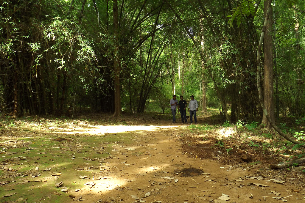
  • Enjoy the drive through the Vazhachal Forest Division, watching for elephants and other wildlife from the road and never getting out near them.
  • Sit quietly by the water and soak in one of Kerala's last riverine rainforests — a slower, nature-first experience.
  • Learn about the Kadar community and the conservation story of the river through local information and responsible guided experiences where available (indicative — confirm locally).

Safety first: the rocks along the Chalakudy River are extremely slippery and the river runs with strong, deceptive currents. Several drowning incidents have occurred at Vazhachal and nearby stretches, and bathing or venturing onto the rocks can be dangerous and is often restricted. Stay behind barriers, keep children close, do not attempt to cross or stand on wet rocks, and follow forest-department signage and confirm locally.

What to expect

Highlights

  • Waterfall viewpoint at Vazhachal Falls
  • Forest-edge scenery
  • Short walks, food stops or nearby viewpoints where available
Getting there

How to visit

  • Base yourself in Thattekkad or a nearby town in Ernakulam, then confirm the last-mile route locally before leaving.
  • Visit early and check whether the falls are open; waterfall access can close quickly in heavy rain.
  • If the visit depends on forest, temple, boat, ferry, weather or seasonal access, check the official/local rule on the day before travel.

Distance by road

  • Kozhikode175 km
  • Coimbatore190 km
  • Thiruvananthapuram206 km
  • Madurai278 km
  • Mysuru348 km

Road km to Ernakulam; ghat roads and traffic vary — allow extra.

Timing

Best time

Post-monsoon is usually strongest; dry months are easier for access but water volume may be lower.

Weather in Vazhachal FallsSeasonal guide

Live forecast loads in your browser.

Visitor notes

  • Wear footwear with grip; rocks can be slippery.
  • Carry a dry bag for phone and documents.
Safety

Good to know

  • Do not enter restricted pools or climb wet rocks.
  • Flash-flood risk rises during heavy rain.
On the map

Where Vazhachal Falls is

Official eco & forest programmes

Forest stays, camping and guided activities linked to Vazhachal Falls

These are official or public-sector eco offerings that match this place, town or forest destination. Confirm availability, permits, tariffs and reporting times with the official operator before travel.

Bhoothathankettu, Vazhachal Falls
boatingtrekviewpoint

Bhoothathankettu eco visit

Dam, forest and river landscape east of Kochi, listed by Kerala Tourism as an ecotourism destination and programme.

Kerala Forest Department / local tourism authorities
Official source →
Paniyeli Poru, Vazhachal Falls
wildlifeviewpoint

Paniyeli Poru forest river visit

Rocky Periyar river landscape and forest-edge destination that needs careful seasonal safety checks.

Kerala Forest Department / local tourism authorities
Official source →
Thattekkad Bird Sanctuary, Vazhachal Falls
birdingwildlifetrek

Thattekkad Bird Sanctuary birding

One of Kerala’s key birding landscapes on the Periyar river, east of Kochi.

Kerala Forest Department
Official source →
Stay · eat · do · rent · see · shop

Stays, food & things to do near Vazhachal Falls

Verified hotels, homestays, restaurants, experiences, sights, shops and rentals around Vazhachal Falls — commission-free, with direct contact. Filter by what you need.

Thattekkad Bird Sanctuary — Attraction in Thattekkad
Top pick Historic
Attraction · Thattekkad
Thattekkad Bird Sanctuary
24.9 km · ~42 min by cab

see option in Thattekkad: Thattekkad Bird Sanctuary is a Attraction option for see planning in Thattekkad, Ernakulam, kerala, India. Use Thattekkad Bird Sanctuary as a see option in Thattekkad, Ernakulam, kerala, India. plan visit duration, crowd timing and transport links. Key details: thattekkad.

DirectionsView guide
Bhoothathankettu — Attraction in Thattekkad
Top pick Historic
Attraction · Thattekkad
Bhoothathankettu
19.5 km · ~32 min by cab

A Periyar reservoir and barrage near Thattekkad — river boating, forest walks and a children’s park. (see option in Thattekkad)

DirectionsView guide
Boothathankettu Dam — Nature in Thattekkad
Top pick Historic
Nature · Thattekkad
Boothathankettu Dam
19.7 km · ~33 min by cab

nature option in Thattekkad: Boothathankettu Dam is a Nature option for nature planning in Thattekkad, Ernakulam, kerala, India. Use Boothathankettu Dam as a discover option in Thattekkad, Ernakulam, kerala, India. check access status, permits and weather windows before visiting. Key details: thattekkad.

DirectionsView guide
Thattekkad Birding Guide Walk — Birding walk in Thattekkad
Top pick Verified
Birding walk · Thattekkad
Thattekkad Birding Guide Walk

do option in Thattekkad: Thattekkad Birding Guide Walk is a Birding walk option for do planning in Thattekkad, Ernakulam, kerala, India. Use Thattekkad Birding Guide Walk as a do option in Thattekkad, Ernakulam, kerala, India. book timing, permits and local support before heading out. Key details: Thattekkad Bird Sanctuary, Ernakulam district, Kerala · Price range: Contact direct / check current rules · Amenities: thattekkad, do, Birding walk.

Commission-freeView details
Soma Birds Lagoon — Resort in Thattekkad
Top pick Verified
Resort · Thattekkad
Soma Birds Lagoon

stay option in Thattekkad: Soma Birds Lagoon is a Resort option for stay planning in Thattekkad, Ernakulam, kerala, India. Use Soma Birds Lagoon as a stay option in Thattekkad, Ernakulam, kerala, India. book your stay, transport and nearby food stops. Key details: Thattekkadu P.O., Palamattam, Kothamangalam, Ernakulam, Kerala 686691 · Price range: Contact direct · Amenities: Thattekkad, Birding, Resort.

Commission-freeView details
Hornbill Camp Thattekkad — Nature camp in Thattekkad
Verified
Nature camp · Thattekkad
Hornbill Camp Thattekkad

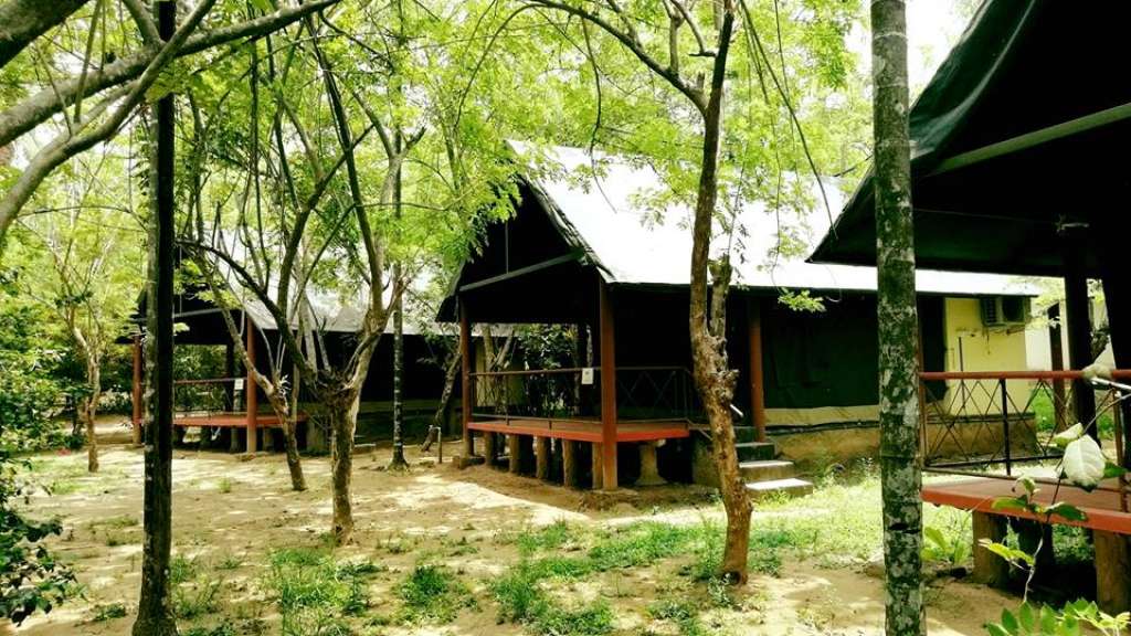
stay option in Thattekkad: Hornbill Camp Thattekkad is a Nature camp option for stay planning in Thattekkad, Ernakulam, kerala, India. Use Hornbill Camp Thattekkad as a stay option in Thattekkad, Ernakulam, kerala, India. book your stay, transport and nearby food stops. Key details: Palamattom, Thattekkad P.O., Ernakulam, Kerala 686681 · Price range: Contact direct · Amenities: Thattekkad, Birding, Nature camp.

Commission-freeView details

Roampedia is commission-free — own or know a stay, eatery, guide or shop near Vazhachal Falls? List it and it appears here once verified.

Add a nearby business
Nearby

What’s near Vazhachal Falls

Athirappilly Falls
waterfallAthirappilly Falls 3.0 km · ~8 min by auto
Malayattoor Church
churchMalayattoor Church 15.9 km · ~26 min by cab
Ezhattumugham
backwaterEzhattumugham 17.5 km · ~29 min by cab
trekBhoothathankettu trek 19.9 km · ~33 min by cab
Thrikkariyoor Temple
templeThrikkariyoor Temple 24.1 km · ~40 min by cab
Good to know

Vazhachal Falls — frequently asked

When is the best time to visit Vazhachal Falls?

Post-monsoon is usually strongest; dry months are easier for access but water volume may be lower.

What are the entry fee and timings at Vazhachal Falls?

Entry: A modest entry ticket typically applies, usually as part of the combined Athirappilly–Vazhachal pass, with separate charges commonly levied for cameras and parking; amounts vary over time (indicative — confirm locally).. Timings: Generally open through daytime hours, with access controlled by the Kerala Forest Department under the shared Athirappilly–Vazhachal entry system; exact opening and closing times can change seasonally (indicative — confirm locally).. Fees and timings are indicative — confirm on site before you travel.

How do I reach Vazhachal Falls?

Base yourself in Thattekkad or a nearby town in Ernakulam, then confirm the last-mile route locally before leaving. Visit early and check whether the falls are open; waterfall access can close quickly in heavy rain. If the visit depends on forest, temple, boat, ferry, weather or seasonal access, check the official/local rule on the day before travel.

How much time do I need for Vazhachal Falls?

1 to 3 hours.

What else is near Vazhachal Falls?

Nearby you can pair Athirappilly Falls (3.0 km), Malayattoor Church (15.9 km), Ezhattumugham (17.5 km), Bhoothathankettu trek (19.9 km).

What should I know before visiting Vazhachal Falls?

Do not enter restricted pools or climb wet rocks. Flash-flood risk rises during heavy rain.

Image credits