Paithalmala trek

Paithalmala is Kannur district's highland trek and viewpoint near the Karnataka border, offering grassland, forest-edge paths and cool ridge views. It is the northern Malabar contrast to Kannur's beaches and forts.

Paithalmala trek, Paithalmala
Practical guide

Plan Paithalmala trek

Typetrek
Nearest basePaithalmala
Best timePost-monsoon to winter is best for green hills and clearer walking
Time neededHalf day locally
EntryA nominal entry fee is usually collected at the base — reported around INR 30 per person (indicative — confirm locally); additional charges may apply for guides, parking or camera. Confirm current rates at the base counter.
Nearest town/basePaithalmala
DistrictKannur
Place typetrek
Time neededHalf day locally; full day from Kannur city.

Paithalmala is Kannur district's highland trek and viewpoint near the Karnataka border, offering grassland, forest-edge paths and cool ridge views. It is the northern Malabar contrast to Kannur's beaches and forts.

Plan it as a weather-sensitive hill trek with limited facilities. Road condition, leeches/rain, mist and local access rules should be checked before departure.

The story

Paithalmala — also spelt Paithal Mala or Pythal Mala — is the highest peak in Kannur district and one of the loftiest points in northern Kerala, rising to roughly 1,372 m (indicative — confirm locally) on the Kerala–Karnataka border in the Western Ghats. A forest trek of about 6 km from the base near Kudiyanmala climbs through shola woodland into open grasslands, delivering sweeping panoramas over the Kannur plains on one side and the Coorg (Kodagu) hills of Karnataka on the other. Cool, misty and green, it has earned the affectionate labels the 'Ooty of Kannur' and the 'Ponmudi of Kannur'.

The story of Paithalmala trek

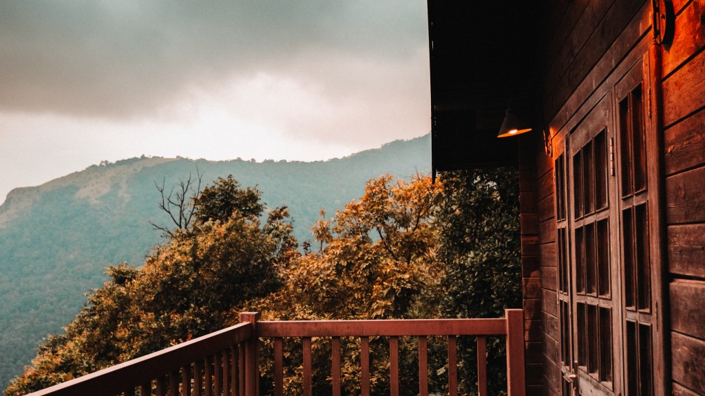
Set on the ridge where Kerala melts into Karnataka, Paithalmala is Kannur's rooftop — a swell of grass-carpeted hill capped at around 1,372 m (indicative — confirm locally) and folded into the wider Western Ghats near the Kodagu (Coorg) forests. It sits far from the coastal bustle of Kannur town, reached by a winding drive up to the settlement of Kudiyanmala and then earned the old-fashioned way, on foot. That combination of remoteness, altitude and near-permanent mist is exactly why travellers borrow the names of Kerala's famous hill stations and call it the 'Ooty of Kannur' or the 'Ponmudi of Kannur'.

The walk itself is the attraction. From the roadhead near Kudiyanmala the trail runs about 6 km to the summit, and there are two recognised approaches — a gentler, more established path from the Pottenplavu/Kudiyanmala side and a tougher route beginning at Kappimala near Alakode, each around 6 km (indicative — confirm locally). The first stretch tunnels through dense, semi-evergreen shola forest, damp and green and loud with birds and butterflies, before the canopy suddenly gives way to rolling open grassland on the shoulder of the hill. Most reasonably fit walkers reach the top in around two hours each way.

At the summit stands a forest and tourism watchtower, a simple observatory platform that lifts you above the last of the grass for an uninterrupted sweep of the horizon. From here, on a clear morning, you can take in more than half of Kannur district spread out below, the ridgelines of the Western Ghats marching away, and — turning north and east — the forested valleys of Coorg dissolving into Karnataka. Cloud shadows race across the meadows and the wind rarely stops; it is the kind of viewpoint that rewards patience while the mist lifts and settles.

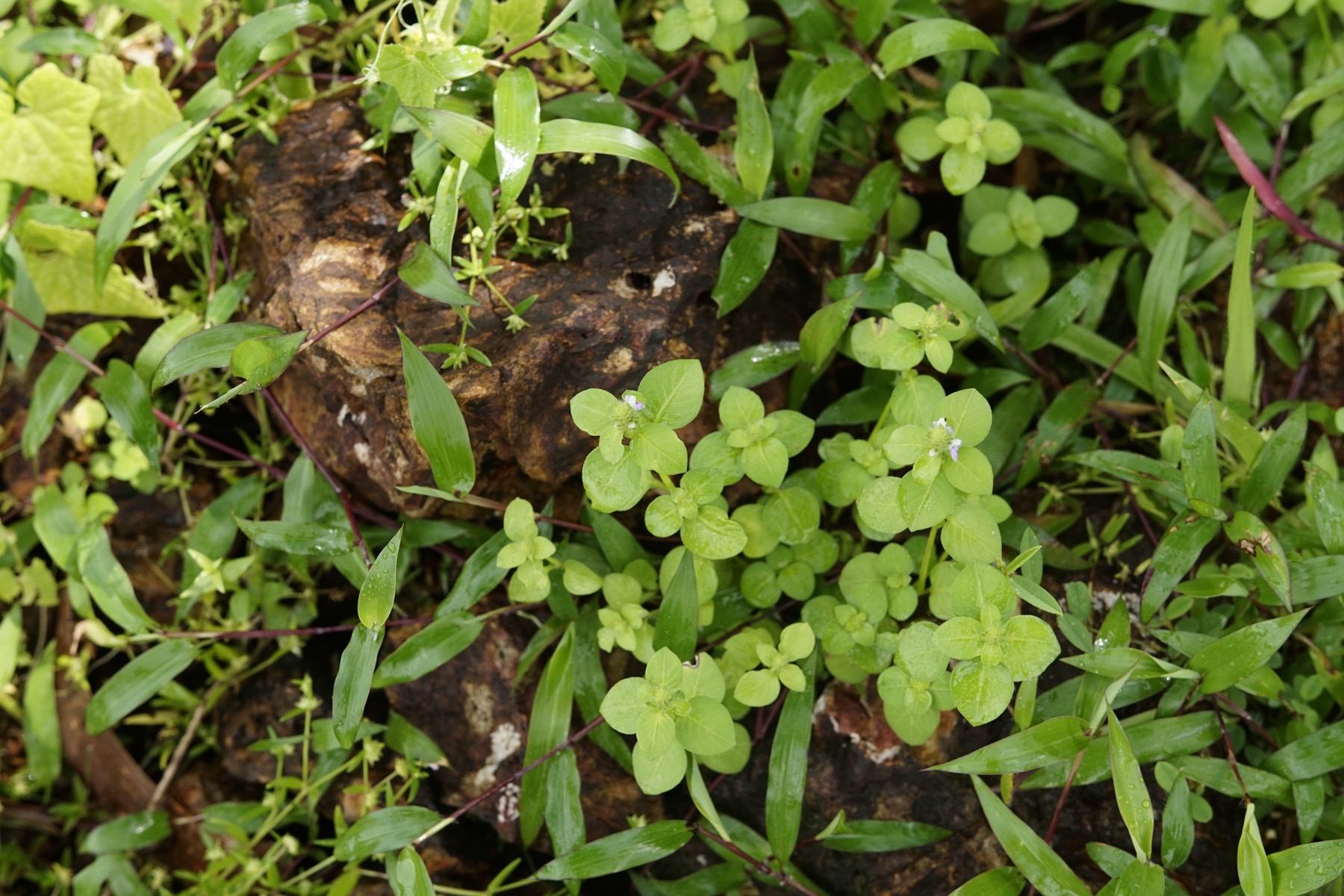
The mountain is as much about biodiversity as about the view. The shola–grassland mosaic here shelters rare endemic flora and fauna of the Western Ghats, and the slopes are known for a remarkable abundance of butterflies — well over a hundred varieties are reported (indicative — confirm locally). After the monsoon the hillside grass shoots up to well above head height before the forest caretakers carry out controlled burning in the cooler months, part of the long-standing cycle of managing these high meadows. Wild elephants occasionally move through the forest belt, a reminder that this is a living reserve rather than a manicured park.

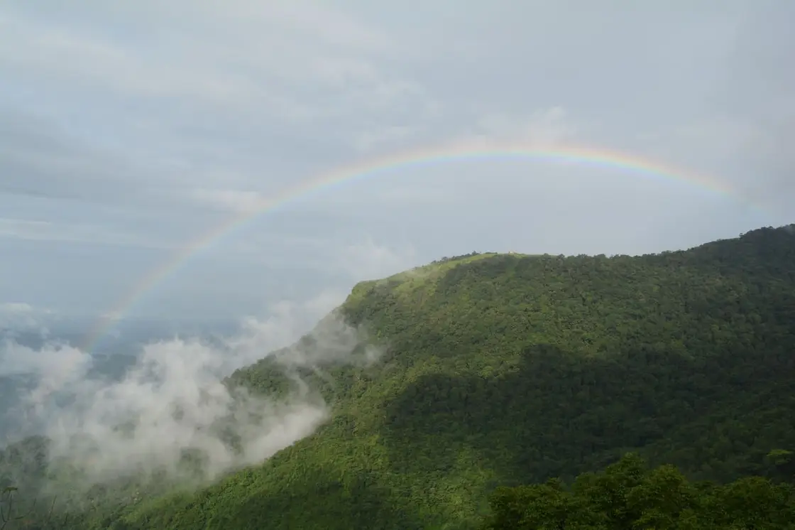
Timing shapes the whole experience. The hills are at their most spectacular during and just after the monsoon, roughly July to September, when the meadows glow emerald, waterfalls run and the ridge floats in cloud — though this is also peak leech season, so long socks, trekking trousers and closed boots are essential. From January to March the going is drier and firmer underfoot and the classic long-view days arrive, but the greenery fades. Whichever season you choose, there are effectively no facilities on top: carry your own water and food, take all litter back down, and start early so you are off the exposed summit well before afternoon weather rolls in.

Practically, a local guide is strongly advisable — the forest sections can be confusing, weather turns fast, and guidance helps with the seasonal permit and safety on the elephant-frequented stretches. Roampedia recommends confirming the current entry fee, opening hours and any forest-department trekking permission at the base before you set out, as these are periodically revised.

History

Paithalmala's name is woven into local memory. In Malayalam 'paithal' means an infant or small child and 'mala' means hill, and folk tradition links the name to the 'Paithalkon' (Vaithalkon) lineage once associated with this corner of Malabar. The hill is therefore also known as Vaithal Mala, and the two names are used interchangeably in older accounts (etymology as locally recounted — treat as tradition rather than documented fact).

The most evocative historical thread is the legend of the tribal chieftain Vaithalkon. Travellers and local guides point to the ruins of what is remembered as the palace of the king Vaithalkon on the heights of the mountain, and reaching the summit is often described as walking into a chapter of Malabar's tribal past. These remains are cited by Kerala Tourism and local sources as relics of former hill royalty, though they are best appreciated as heritage-by-tradition rather than a formally excavated monument (confirm details locally).

Beyond the legend, Paithalmala's story is largely a forest-and-settlement one. Lying on the frontier where the old kingdoms and forest tracts of north Malabar met the Kodagu (Coorg) uplands of what is now Karnataka, the region was for centuries a thinly peopled zone of shifting cultivation, forest produce and hill hamlets, gradually brought under formal forest administration in the colonial and post-Independence periods.

In modern times the peak has been developed lightly for eco-tourism. The forest and tourism departments erected the summit watchtower and manage the trekking access, and the surrounding meadows are maintained through the traditional seasonal burning of the tall post-monsoon grass. The hill has become one of Kannur's signature trekking destinations while remaining, by design, largely undeveloped at the top.

Conservation is now the running theme of its recent history. Because the summit draws day-trippers, authorities and local bodies have periodically flagged litter and the poor upkeep of the watchtower, and there are recurring appeals to protect the fragile shola–grassland ecosystem and its endemic wildlife. Responsible, low-impact visiting — carrying out all waste and sticking to marked paths — is the single most useful thing a traveller can do here.

Why visit

Stand on Kannur's highest point — a summit of roughly 1,372 m (indicative — confirm locally) — and look out over more than half the district on one side and the Coorg hills of Karnataka on the other.

Walk a genuine Western Ghats trek of about 6 km that threads from dense shola forest into wide-open, wind-combed grassland, with two route options for different fitness levels.

Chase the monsoon greenery: from July to September the meadows turn emerald, mist drifts across the ridge and seasonal streams and waterfalls come alive.

Spot rich biodiversity — over a hundred reported butterfly varieties (indicative — confirm locally) plus rare endemic Western Ghats flora and fauna in the shola–grassland mosaic.

Climb the summit watchtower for a 360-degree panorama across the Kerala–Karnataka frontier, one of the finest natural viewpoints in northern Kerala.

Trace a slice of Malabar legend at the reputed ruins of the tribal king Vaithalkon's palace, from which the hill takes its alternate name, Vaithal Mala.

Trek facts

Paithalmala trek — at a glance

TimingsDaytime trekking only; typically open in daylight hours and closed after dark for safety (indicative — confirm locally). Start early to complete the climb and descent well before afternoon weather. Access may be restricted during heavy monsoon spells or forest-department closures.
Best timeTwo windows: the monsoon and post-monsoon (roughly July–September) for lush green, misty, waterfall-fed scenery (but heavy leech activity); and the cooler, drier months (roughly January–March) for firmer trails and clearer panoramic views (indicative — confirm locally).

Entry: A nominal entry fee is usually collected at the base — reported around INR 30 per person (indicative — confirm locally); additional charges may apply for guides, parking or camera. Confirm current rates at the base counter.

Dress code: Practical trekking wear: closed trekking shoes/boots with grip, long trousers and long socks (leech protection in the rains), a rain layer in the monsoon, sun protection and a hat in the dry season. No special religious dress code applies.

Festivals: No temple festival or fixed event is associated with the peak itself; it is a natural trekking and viewpoint destination rather than a place of worship.

Photography: Photography is freely allowed and encouraged — the grasslands, mist, butterflies and Kerala–Karnataka panoramas are the highlights. Carry a rain cover for gear in the monsoon; any drone use should be checked against forest-department rules (indicative — confirm locally).

Getting here

How to reach Paithalmala trek

  • ✈︎ By air The nearest airport is Kannur International Airport (CNN), roughly 60–70 km away (indicative — confirm locally); Kozhikode (Calicut) International Airport and Mangalore International Airport are the next options, each a longer road journey, with taxis available onward to Kudiyanmala.
  • 🚆︎ By train The nearest major railhead is Kannur railway station, about 65 km from the peak (indicative — confirm locally); from there hire a taxi or use buses toward Thaliparamba and Kudiyanmala for the final approach to the base.
  • 🚗︎ By road By road, drive via Thaliparamba and Alakode/Kudiyanmala into the hills; the final stretch to the roadhead is narrow and winding, and a stretch of tarred road runs up to near Kudiyanmala before the trek begins (indicative — confirm locally). Self-drive or a hired car is the most flexible option.
  • 🚌︎ By bus KSRTC and private buses connect Kannur and Thaliparamba with towns near the base such as Kudiyanmala/Alakode; services thin out close to the hill, so plan the last leg by taxi or auto-rickshaw and check return timings in advance (indicative — confirm locally).
Do

Things to do

  • Trek the roughly 6 km forest-and-grassland trail to the summit
  • Climb the watchtower/observatory for panoramic views across Kannur and into Coorg (Karnataka)
  • Watch for butterflies and rare Western Ghats endemic flora and fauna in the shola forest
  • Photograph the mist-laden meadows and sweeping ridge-line vistas
  • Detour to the seasonal Ezharakundu (Ezhara Kund) waterfalls reported en route for a rest stop (indicative — confirm locally)
  • Seek out the reputed ruins linked to the tribal king Vaithalkon on the heights

There are no facilities, shops, drinking water or toilets at the summit — carry your own water, food and essentials, and take all litter back down. Watch for leeches in the monsoon and for occasional wild elephants in the forest belt; a local guide is strongly advisable and starting early is important for safety.

What to expect

Highlights

  • Hill trek and viewpoint in eastern Kannur.
  • Pairs with Kudiyanmala/Kappimala routes, Aralam and Kannur city stays.
  • Inventory priority for homestays, drivers, guides and trek-friendly food stops.
Getting there

How to visit

  • Base in Paithalmala/Kudiyanmala or Kannur city with an early start.
  • Confirm route condition and local access before setting out.
  • Carry water, proper shoes, rain protection and a light layer.

Distance by road

  • Kozhikode92 km
  • Mangaluru143 km
  • Mysuru179 km
  • Coimbatore267 km
  • Kochi270 km

Road km to Kannur; ghat roads and traffic vary — allow extra.

Timing

Best time

Post-monsoon to winter is best for green hills and clearer walking. Heavy rain and mist can make the route unsafe.

Weather in Paithalmala trekSeasonal guide

Live forecast loads in your browser.

Visitor notes

  • Facilities are limited; verify meals and stay basics.
  • Mist can hide views quickly.
  • Listings should identify exact village/base rather than only Kannur district.
Safety

Good to know

  • Avoid ridges during lightning, heavy rain or low visibility.
  • Stay on known routes and use local guidance.
  • Plan return before dark on unfamiliar hill roads.
On the map

Where Paithalmala trek is

Official eco & forest programmes

Forest stays, camping and guided activities linked to Paithalmala trek

These are official or public-sector eco offerings that match this place, town or forest destination. Confirm availability, permits, tariffs and reporting times with the official operator before travel.

Paithalmala, Paithalmala trek
trekviewpoint

Paithalmala trek

About 5 km trek through semi-evergreen shola forest and grassland to a high viewpoint above Kannur and Coorg valleys.

Kerala Forest Department / local tourism authoritiesDay trek
Official source →
Stay · eat · do · rent · see · shop

Stays, food & things to do near Paithalmala trek

Verified hotels, homestays, restaurants, experiences, sights, shops and rentals around Paithalmala trek — commission-free, with direct contact. Filter by what you need.

Paithal Hill Resorts Restaurant — Hill resort restaurant in Paithalmala
Top pick Verified
Hill resort restaurant · Paithalmala
Paithal Hill Resorts Restaurant

Paithal Hill Resorts Restaurant is a sourced hill resort restaurant record for the paithalmala guide. (eat option in Paithalmala)

Commission-freeView details
Holistic Eco-Resort Paithalmala — Eco resort in Paithalmala
Top pick Verified
Eco resort · Paithalmala
Holistic Eco-Resort Paithalmala

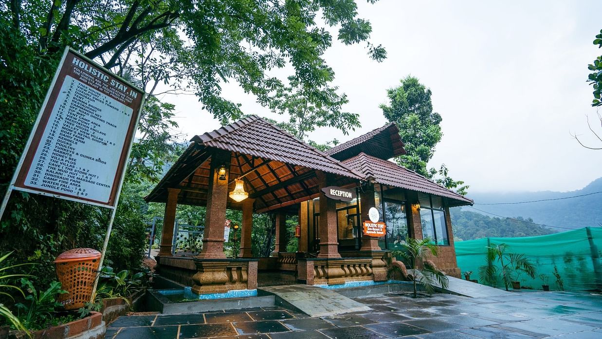
stay option in Paithalmala: Holistic Eco-Resort Paithalmala is a Eco resort option for stay planning in Paithalmala, Ernakulam, kerala, India. Use Holistic Eco-Resort Paithalmala as a stay option in Paithalmala, Ernakulam, kerala, India. book your stay, transport and nearby food stops. Key details: No. 2/199, Paithalmala Road, Pottenplave, Chandanakampara, Vanchiyam, Kerala 670582 · Price range: Contact direct / check current rates · Amenities: stay, Eco resort, Holistic Eco-Resort Paithalmala.

Commission-freeView details
Travel Kannur Paithalmala Guide Services — Local guide and accommodation support in Paithalmala
Top pick Verified
Local guide and accommodation support · Paithalmala
Travel Kannur Paithalmala Guide Services

Local Paithalmala guide, accommodation and trekking-support source for visitors needing practical hill-route help. (do option in Paithalmala)

Commission-freeView details
Paithalmala Kerala Tourism — Hill trek in Paithalmala
Verified
Hill trek · Paithalmala
Paithalmala Kerala Tourism

do option in Paithalmala: Paithalmala Kerala Tourism is a Hill trek option for do planning in Paithalmala, Ernakulam, kerala, India. Use Paithalmala Kerala Tourism as a do option in Paithalmala, Ernakulam, kerala, India. book timing, permits and local support before heading out. Key details: Pottanplavu PO, Kudiyanmala, Paithalmala, Kannur, Kerala 670582 · Price range: Check current access · Amenities: Paithalmala, Pythal Mala, Kannur trek.

Commission-freeView details
P
Paithalmala Manjapullu Forest Trekking
Things to do
Top pick Verified
Official forest ecotourism trekking · Paithalmala
Paithalmala Manjapullu Forest Trekking

Official Kerala Forest Ecotourism trekking source for Manjapullu and Paithalmala in the Western Ghats of Kannur. (do option in Paithalmala)

Commission-freeView details
P
Paithal Hill Resorts
Place to stay
Top pick Verified
Hill resort · Paithalmala
Paithal Hill Resorts

stay option in Paithalmala: Paithal Hill Resorts is a Hill resort option for stay planning in Paithalmala, Ernakulam, kerala, India. Use Paithal Hill Resorts as a stay option in Paithalmala, Ernakulam, kerala, India. book your stay, transport and nearby food stops. Key details: Paithalmala, Kannur, Kerala · Price range: Contact direct · Amenities: Paithalmala stay, Hill resort, Trekking base.

Commission-freeView details

Roampedia is commission-free — own or know a stay, eatery, guide or shop near Paithalmala trek? List it and it appears here once verified.

Add a nearby business
Nearby

What’s near Paithalmala trek

Palakkayam Thattu
viewpointPalakkayam Thattu 6.7 km · ~17 min by auto
Pazhassi Dam
damPazhassi Dam 22.1 km · ~37 min by cab
Kalarivathukkal Temple
templeKalarivathukkal Temple 36.0 km · ~60 min by cab
Madayipara
viewpointMadayipara 36.9 km · ~62 min by cab
Good to know

Paithalmala trek — frequently asked

When is the best time to visit Paithalmala trek?

Post-monsoon to winter is best for green hills and clearer walking. Heavy rain and mist can make the route unsafe.

What are the entry fee and timings at Paithalmala trek?

Entry: A nominal entry fee is usually collected at the base — reported around INR 30 per person (indicative — confirm locally); additional charges may apply for guides, parking or camera. Confirm current rates at the base counter.. Timings: Daytime trekking only; typically open in daylight hours and closed after dark for safety (indicative — confirm locally). Start early to complete the climb and descent well before afternoon weather. Access may be restricted during heavy monsoon spells or forest-department closures.. Fees and timings are indicative — confirm on site before you travel.

How do I reach Paithalmala trek?

Base in Paithalmala/Kudiyanmala or Kannur city with an early start. Confirm route condition and local access before setting out. Carry water, proper shoes, rain protection and a light layer.

How much time do I need for Paithalmala trek?

Half day locally; full day from Kannur city.

What else is near Paithalmala trek?

Nearby you can pair Palakkayam Thattu (6.7 km), Pazhassi Dam (22.1 km), Rajarajeswara Temple, Taliparamba (26.8 km), Parassinikadavu Muthappan Temple (27.8 km).

What should I know before visiting Paithalmala trek?

Avoid ridges during lightning, heavy rain or low visibility. Stay on known routes and use local guidance. Plan return before dark on unfamiliar hill roads.

Image credits