Ilaveezhapoonchira is a wide, rolling grassland ringed by three hills on the Kottayam–Idukki border, famous for its sweeping high-range views, monsoon-green meadows and one of the most photographed sunrises and sunsets in central Kerala.
The story of Ilaveezhapoonchira
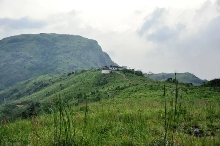
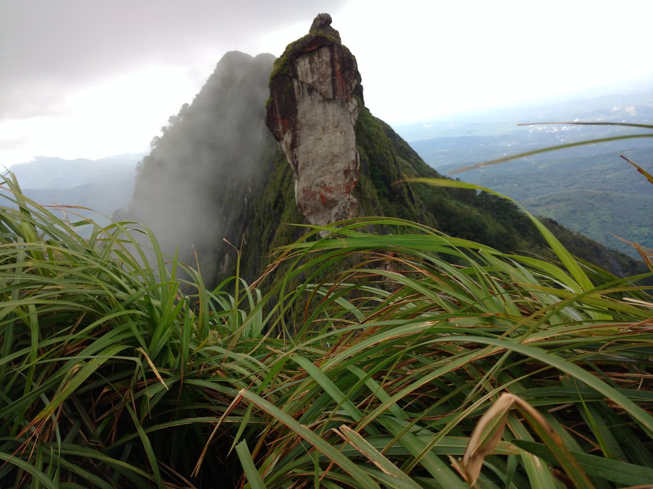
High on the boundary of Kottayam and Idukki districts, near Melukavu and Kanjar, Ilaveezhapoonchira is one of those places that reveals itself slowly. The last stretch of road climbs through rubber and cardamom country, then the trees fall away and the land opens into bare, rolling grassland. Three green hills — Mankunnu, Kodayathoormala and Thonippara — stand around a shallow valley, and on a clear morning the whole plateau seems to float above the mist gathered in the lowlands below.
The high point sits at roughly 962 metres, about 3,200 feet above sea level (indicative — confirm locally), and the reward for reaching it is a genuinely enormous view. From the ridgelines, visitors are said to be able to pick out parts of as many as six neighbouring districts — Idukki, Kottayam, Ernakulam, Alappuzha, Pathanamthitta and Thrissur — with the sheet of the Malankara reservoir catching the light far below. On hazy days the horizon shrinks, but the drama of standing on an open grass ridge with valleys falling away on every side does not.
The name itself is the first thing most visitors ask about. Ilaveezhapoonchira is usually explained as ‘the poonchira where leaves do not fall’ — ila meaning leaf, veezha meaning to fall, and poonchira meaning a meadow-pond or floral basin. The plain reason offered locally is simple and true to the landscape: the hilltops are grassland with almost no large trees, and the constant wind sweeps the slopes clean, so there are no leaves to shed into the hollow. The more romantic explanation belongs to legend, and it is one of the reasons the place has stayed in local imagination for so long.
The other great draw is the poonchira itself. For much of the year the central basin is a green hollow, but during the south-west monsoon, roughly June to August, water gathers off the surrounding hills and pools into a shallow seasonal lake — the ‘pond’ the name promises. This is the season the meadows are at their most vivid, wrapped in cloud that can roll in even at midday, and it is also when the ground is at its most slippery and the weather at its least predictable.
Because there is so little between you and the sky here, Ilaveezhapoonchira has become a favourite with campers and photographers who come up for the sunrise and stay for the sunset. Many string it together with Vagamon and the small Kunjila Dam near Kanjar to make a highland loop through the Erattupetta highlands. Facilities on the hill are minimal — this is open meadow and cliff edge, not a built-up viewpoint — so the visit is as much about the walk, the wind and the changing light as it is about any single spot to stand.
Legend & myth
The best-known story attached to Ilaveezhapoonchira comes from the Mahabharata and is told as legend rather than history. It holds that the Pandava brothers passed time here during their long exile in the forest, and that Draupadi (also called Panchali) would come down to bathe in the pond in the valley.
In the popular version of the tale, celestial beings tried to spy on her, and Lord Indra, king of the devas, is said to have raised the surrounding hills and heaped them with flowers to screen the pond from prying eyes — leaving the isolated, flower-fringed basin that gives the place its poetic reputation. Another strand of the legend credits Bhima with building the pond for Panchali, and speaks of an old Krishna temple on the hill said to have been founded by Panchali herself.
These are devotional and folkloric traditions, not documented events, and locals tell them as part of the area’s lore. Whichever version you hear, it captures the same idea the plain explanation does — a green, treeless bowl in the hills where leaves never gather.
History
Ilaveezhapoonchira has little in the way of formal recorded history; its story is largely one of landscape and local memory rather than dynasties or monuments. For generations it was known chiefly to people of the surrounding Melukavu, Kanjar and Teekoy highlands as high grazing land and grassland on the Kottayam–Idukki frontier, wrapped up with the Pandava and temple legends that still cling to it.
What changed its fortunes was tourism. As central Kerala’s hill destinations grew in popularity, Ilaveezhapoonchira came to be promoted as a trekking and viewpoint destination, appearing on Kerala Tourism and Kottayam district listings as a scenic highland stop for both domestic and foreign visitors. Its combination of easy grandeur — big views for relatively little effort — and its unusual name helped it spread by word of mouth and photograph.
Development has stayed light. The site is reached by a ghat road that ends short of the ridges, and visitors typically walk the final stretch to the high points. There are no large resorts or ticketed complexes on the meadow itself, and services such as food, water and lodging are concentrated in the villages below rather than on the hill.
Because it sits close to the Kottayam–Idukki boundary, Ilaveezhapoonchira is often bracketed with the wider Vagamon–Erattupetta highland belt in tourism circuits, and the nearby Kunjila Dam is sometimes added to a day out from Pala or Erattupetta. Visitors should treat any single ‘official’ claim about heights, timings or facilities cautiously and confirm current arrangements locally, as details on the ground can change season to season.
Why visit
The panoramic views are the headline: open grass ridges with valleys falling away on all sides, and — on clear days — a horizon said to take in parts of up to six districts and the distant Malankara reservoir.
Sunrise and sunset here are locally legendary, with the meadows and mist catching colour in a way that has made the spot a magnet for photographers.
In the monsoon the central basin fills into a shallow seasonal lake and the hills turn intensely green, delivering the ‘poonchira’ the name promises.
The three grass hills — Mankunnu, Kodayathoormala and Thonippara — give a satisfying trek and walk-up without demanding serious mountaineering, ideal for casual trekkers and nature lovers.
It is a popular, relatively wild camping spot, prized precisely because there is so little development between you and the open sky.
Its position lets you fold it into a wider highland circuit with Vagamon and the small Kunjila Dam near Kanjar, making a rewarding loop through the Pala–Erattupetta highlands.