A vast triangular fortress of rust-red laterite juts into the Arabian Sea at Kannur, its cannon-studded ramparts staring down over a fishing bay that Portuguese, Dutch and British flags all once fought to own.
The story of St. Angelo Fort
St Angelo Fort — known locally as Kannur Kotta or Kannur Fort — sprawls across a low headland on the northern edge of Kannur town, wedged between the open Arabian Sea and the sheltered curve of Mappila Bay. Built almost entirely of Kerala’s signature laterite, its walls glow a deep ochre-red in the low sun, and the whole structure is laid out in a broad triangle so that its guns could sweep the sea approaches from every angle. Walk in across the old approach and you are treading ground that changed hands between three European empires and one indigenous Muslim kingdom.
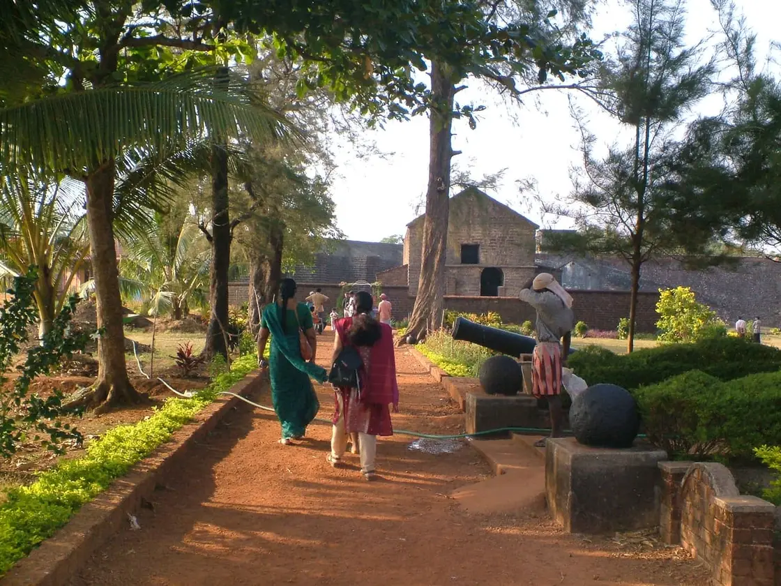
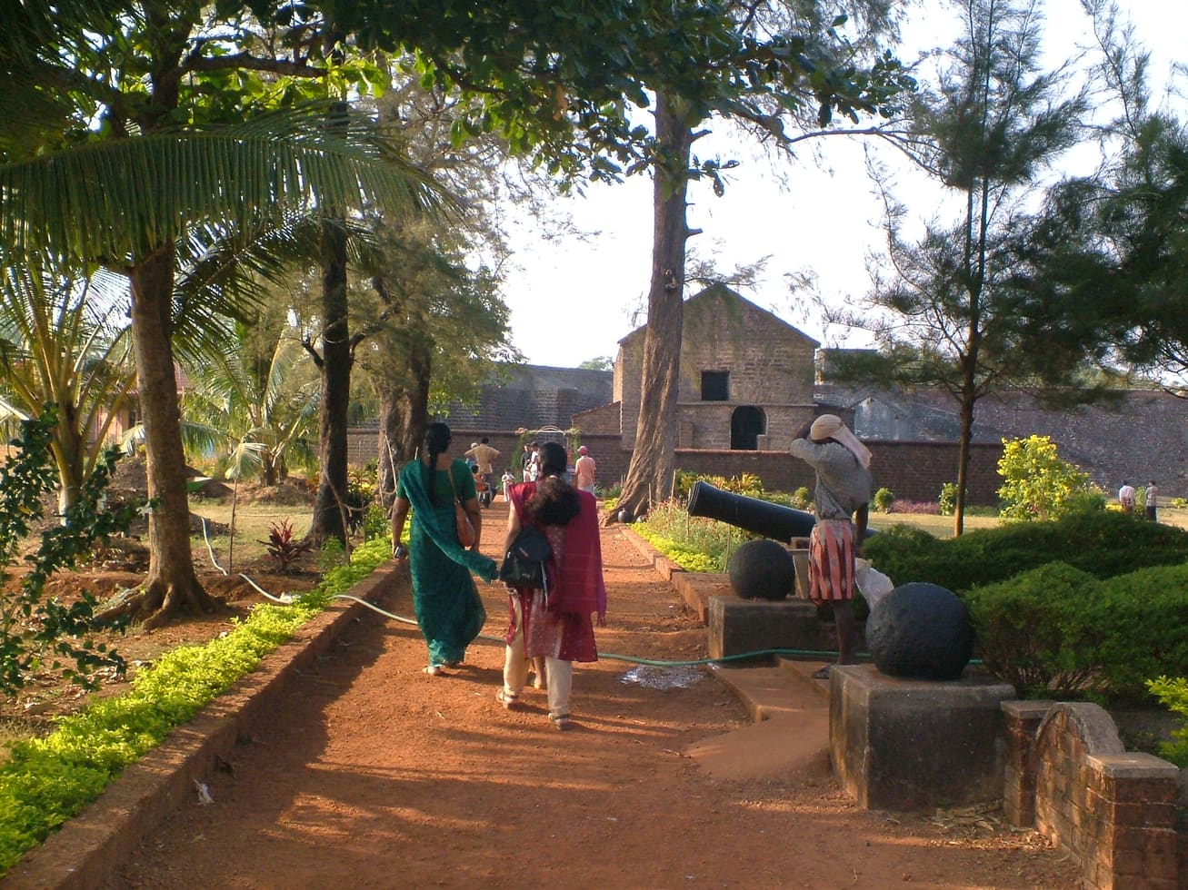
The scale is what strikes visitors first. Thick, weather-blackened ramparts rise well above head height, wide enough in places to walk along, and they enclose a green, breezy interior of lawns, ruined barracks and shaded walls. A deep dry moat once ringed the landward side, crossed historically by a drawbridge that sealed the fort off from attack. The seaward walls fall almost straight to the rocks and surf below, and it is easy to picture sentries scanning the horizon for hostile sails.
The three great angular bastions that dominate the fort today are a Dutch legacy — they named them Hollandia, Zeelandia and Frieslandia after provinces of their homeland — and it is from these projecting corners that the fort’s best sea views open up. Old iron cannons still lie along the parapets and in the grass, some pointed out to sea, and in 2015 workers unearthed thousands of heavy stone and iron cannonballs buried within the grounds, apparently stockpiled long ago as a store of ammunition.
Scattered through the complex are the quieter human traces of its garrisons: a small chapel, since restored; the remains of an early oil-lamp lighthouse; the footings of barracks, stables and a watchtower; and a Dutch-era cemetery whose seventeenth-century gravestones still mark soldiers who died far from Europe. Layer upon layer of masonry — Portuguese foundations, Dutch bastions, British service buildings — makes the fort feel like a stone diary of Malabar’s colonial centuries.
But the reason most travellers linger is the view. From the ramparts you look straight down onto Mappila Bay, a natural fishing harbour where brightly painted wooden boats cluster and nets are hauled in against a backdrop of open ocean. The Arabian Sea stretches unbroken to the west, and at dusk the whole fort turns copper-gold as the sun drops into the water — one of the finest sunset perches on Kerala’s north coast.
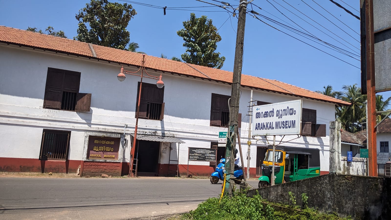
For all its weight of history, St Angelo remains an easy, atmospheric place to wander. It sits barely 3 km from Kannur town centre, next door to the Arakkal Museum and a short hop from Payyambalam Beach, so it slots neatly into a half-day exploration of Kannur’s seafront. Sea breeze, red walls, old guns and a working harbour below — it is a monument that still feels connected to the living coast around it.
History
The fort was raised by the Portuguese in 1505, the year they established their first foothold on the Malabar Coast. On the orders of Dom Francisco de Almeida, the first Portuguese Viceroy of India, the foundation stone was laid on 24 October 1505 by the factor Gonçalo Gil Barbosa, and a timber fort was completed within days, by about 30 October, garrisoned by around 150 men under its first captain, Lourenço de Brito. From 1507 the Portuguese began rebuilding it in stone, turning it into their principal stronghold and a protected trading base for the pepper and spice trade of northern Kerala.
The fort was contested almost from the start. In 1507 the combined forces of the Zamorin of Calicut and the Kolathiri raja are recorded as attacking the Portuguese here without success, and through the sixteenth century St Angelo remained a hard point in the running maritime struggles along the Malabar Coast, in an era dominated by the naval resistance of the Kunjali Marakkars and local rulers against Portuguese sea power.
European control changed hands in the seventeenth century. On 15 February 1663 the Dutch captured the fort from the Portuguese. It was the Dutch who gave St Angelo much of its present form, strengthening and reshaping the defences and adding the three prominent bastions still named Hollandia, Zeelandia and Frieslandia. In 1772 the Dutch sold the fort to the Ali Raja of Arakkal — the head of the Arakkal royal house, the only Muslim ruling dynasty of Kerala — whose seat lay close by on the same stretch of coast.
The fort’s final change of masters came with the rise of British power in Malabar. In 1790 the British seized St Angelo, and they went on to make it their chief military station in the Malabar region, a role it is recorded as holding right up to Indian independence in 1947. British-era barracks and administrative buildings added yet another layer to the already much-rebuilt fortress.
Today St Angelo Fort is a nationally protected monument in the care of the Archaeological Survey of India (ASI), which maintains the ramparts, bastions, chapel and grounds. Its blend of Portuguese origins, Dutch bastions and British service buildings, set on a dramatic sea headland, makes it one of the most important and evocative colonial-era forts on India’s west coast.
Why visit
Huge, atmospheric laterite sea-fort — one of the most important colonial forts on Kerala’s coast.
A rare monument that flew Portuguese, Dutch, Arakkal and British flags in turn, with masonry from each era.
Sweeping ramparts and Dutch bastions with panoramic views over Mappila Bay and the Arabian Sea.
Old iron cannons, a dry moat, a restored chapel and a seventeenth-century Dutch cemetery to explore.
One of North Kerala’s best sunset spots, with a working fishing harbour spread out below.
Right beside the Arakkal Museum and minutes from Payyambalam Beach — an easy half-day in Kannur.