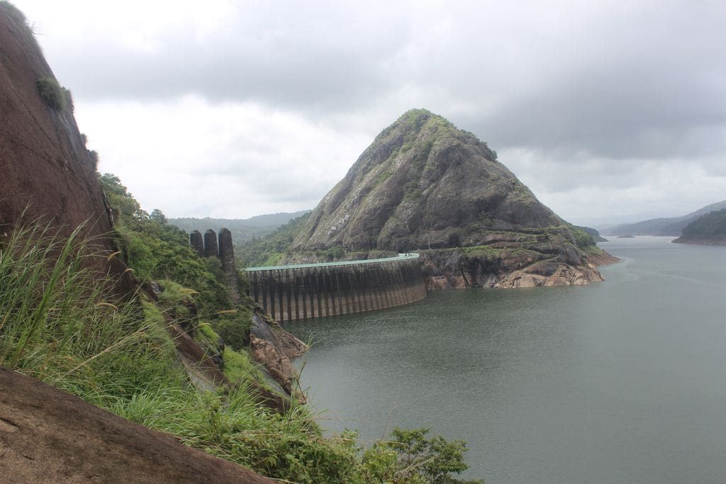
Cheruthoni Dam is the great concrete gravity wall that seals the Cheruthoni gorge and, with the soaring Idukki arch dam on the Periyar and the low Kulamavu saddle dam, locks up the vast Idukki reservoir — the beating heart of one of India’s largest hydroelectric schemes. It is the spillway dam of the trio: the one with the giant steel shutters that, on the rare days they lift, send the Cheruthoni river roaring white through the town below. Not a shrine but a monument to 1970s engineering ambition, it rewards the traveller who comes for scale, high-mountain reservoir views and a genuinely dramatic story rather than for legend.
The story of Cheruthoni Dam
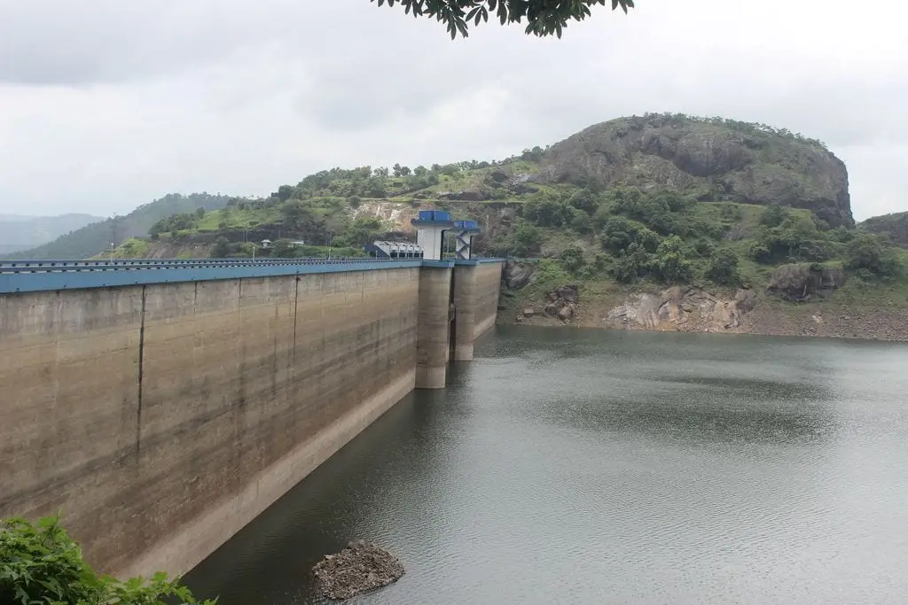
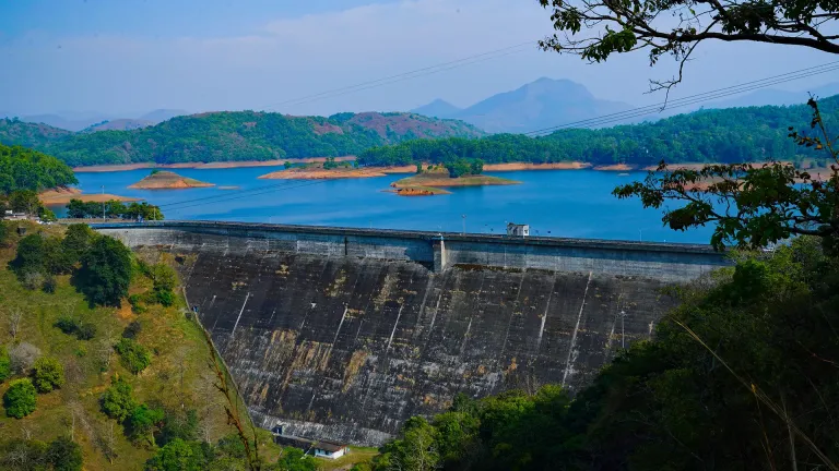
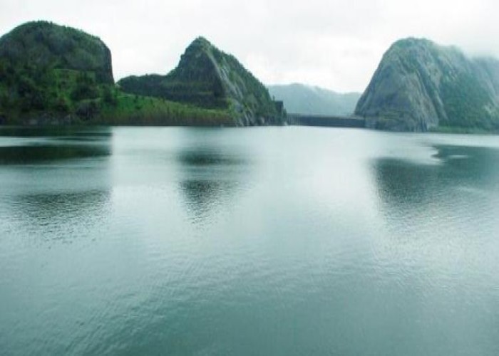
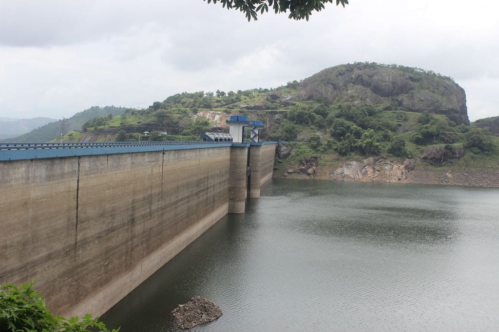
Stand in Cheruthoni town and look up: a pale, stepped cliff of concrete rises across the river mouth, blunt and enormous, so plainly man-made that it takes a moment to read it as a dam at all. This is the gravity dam — it holds back water by sheer dead weight of concrete — and it is only one third of the story. Around the shoulder of the hills, hidden from the town, the celebrated Idukki arch dam curves like a taut bowstring between two rock walls known as the Kuravan and Kurathi hills, while several kilometres away the long, low Kulamavu embankment plugs a third leak in the ridgeline. Together the three dams do a single job: they turn a chain of Western Ghats valleys into one immense mountain lake, the Idukki reservoir.
The genius of the site is geography. Rain-heavy ridges funnel the Periyar’s headwaters into a natural basin ringed by hills; block the three low points and you create a reservoir that stores water high in the mountains, then drop that water through a tunnel to a power station far below to spin turbines. Cheruthoni’s special role is safety valve. When the reservoir climbs toward its limit, it is Cheruthoni’s spillway gates — not the arch dam — that are raised to let the excess thunder away down the Cheruthoni river. For most of the year those gates stay shut and the town lives quietly beneath a placid wall of water (structural and operating figures are indicative — confirm locally).
That quiet is the whole point of the drama. Because the reservoir is so large and so carefully managed, the shutters open only once in a very long while — a handful of times in the project’s entire history. On the days it happens, word travels fast and crowds gather along the banks and bridges to watch controlled cataracts blast out of the spillway in clouds of spray and noise. It is one of Kerala’s rare engineered spectacles, closer to a Himalayan glacier-burst in feel than to anything you associate with palm-fringed backwaters, and it is entirely weather-dependent — you cannot schedule a visit around it (confirm any shutter operation and access with Idukki DTPC or KSEB locally).
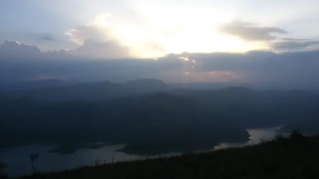
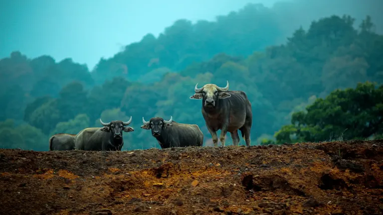
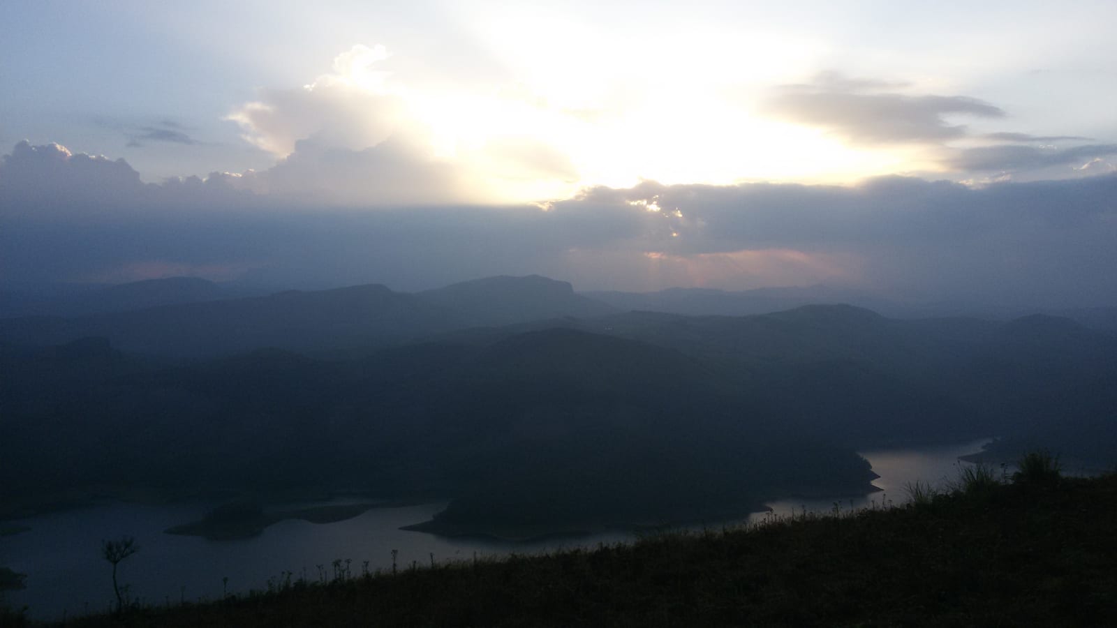
Ringing the water is some of the highest, greenest country in Kerala. Cardamom and tea slopes climb the surrounding hills; mist sits in the valleys at dawn; the reservoir itself falls partly inside protected forest, so elephants, gaur and other wildlife move along its far shores where no road goes. From viewpoints on the approach roads the lake reveals itself in flashes between the trees — a sheet of steel-blue water folded improbably into ridge after ridge of jungle. It is a landscape that makes the engineering feel even bolder: humans threading concrete and steel into a corner of the Ghats that otherwise belongs to the forest.
It is worth being honest about what a visit is and is not. These are working, strategically important power installations, and public access is controlled — the arch dam in particular is usually viewable only on limited open days and photography near the structures can be restricted. Much of what casual visitors actually see is the Cheruthoni dam and reservoir from the town, roadside viewpoints and sanctioned lookout points rather than a walk across the crest. Come for the setting, the sense of scale and the story, keep your expectations of close-up access modest, and check the current rules before you plan (confirm access and open days with Idukki DTPC or KSEB locally).
For all its industrial purpose, Cheruthoni has become the anchor of a whole hill-town identity. The dam gave rise to the town, the town serves the district headquarters at Painavu on the hill above, and the reservoir defines the region’s weather, its livelihoods and its most famous view. To understand Idukki district at all is to understand this: a place literally shaped, named and half-created by a dam.
History
The Idukki project belongs to independent India’s great dam-building decades. Surveys of the Periyar’s hydro potential in this gorge go back to the first half of the twentieth century, but serious construction gathered pace through the late 1960s and into the 1970s, when harnessing Western Ghats rivers for power was seen as central to Kerala’s and India’s development. Cheruthoni was raised alongside its two sibling dams as a single coordinated scheme rather than as a standalone structure (dates and sequence are indicative — confirm locally).
The project is closely tied to Canadian collaboration. The Government of Canada supported the Idukki scheme through long-term loans and grants, and Canadian engineering expertise fed into the design and supervision, with a Canadian consulting firm associated with the works and Indian contractors — notably Hindustan Construction Company — executing the build. It stands as one of the better-known examples of Indo-Canadian development cooperation of that era (details indicative — confirm locally).
By the mid-1970s the dams were complete and the scheme was commissioned — commonly dated to around 1975–1976 — feeding water through a tunnel system to an underground power house at Moolamattom, set deep inside a hill so that the reservoir’s stored head could be converted into electricity on a large scale. The installed capacity of the Idukki generating station runs into several hundred megawatts, historically a major share of Kerala’s own hydro generation (capacity and commissioning figures are indicative — confirm with KSEB locally).
The Cheruthoni spillway’s own history can almost be told in a handful of dates, because its gates are lifted so seldom. Reported openings cluster decades apart — accounts point to the early 1980s, the early 1990s, and then, after a very long gap, the extraordinary monsoon of 2018. Each opening is a landmark in local memory precisely because it is so rare (exact dates indicative — confirm locally).
The 2018 Kerala floods gave Cheruthoni its most dramatic modern chapter. After the reservoir filled to near capacity in a monsoon of historic ferocity, the spillway shutters were raised for the first time in about a quarter of a century, and at the peak all of the gates were opened together — an event without precedent in the project’s history. The controlled release surged down the Cheruthoni river, inundating parts of Cheruthoni town and adding to downstream flooding far toward the Kochi lowlands, and it became one of the defining images of that catastrophic season. It remains a sober reminder that the reservoir’s calm surface sits above enormous stored energy (details indicative — confirm locally).
Why visit
Sheer engineering scale. Few places in Kerala let you stand beneath a concrete wall this size and grasp, at a glance, the ambition of a mountain hydro scheme — the blunt gravity dam in front of you is only one piece of a three-dam system holding back an entire valley of water.
The trio of dams and the reservoir. The chance to make sense of how Cheruthoni, the famous Idukki arch dam and the Kulamavu saddle dam work together to create one of India’s great man-made lakes is a genuinely satisfying puzzle to solve on the ground, ridge by ridge (access to each varies — confirm locally).
High Western Ghats scenery. Cardamom and tea hills, mist-filled valleys, forest-fringed water and cool mountain air make the setting spectacular in its own right, quite apart from the concrete — this is some of the highest, greenest terrain in the state.
A rare and dramatic spectacle. On the very occasional days the spillway gates are opened, the release of water is one of Kerala’s few truly engineered natural spectacles — thunderous, spray-wreathed and unforgettable — though it is weather-dependent and cannot be planned for (confirm any shutter operation with KSEB or DTPC locally).
A powerful, honest story. The 1970s Indo-Canadian construction saga and the searing memory of the 2018 flood shutter-opening give the site a narrative weight that most viewpoints lack — you leave understanding something real about Kerala, its power supply and its vulnerability to the monsoon.
The gateway to Idukki’s hills. Cheruthoni and the neighbouring district town of Painavu make a natural base for exploring the wider Idukki highlands — spice plantations, viewpoints, wildlife country and hill roads all fan out from here.