The story
A ruined 17th-century laterite fort crowning a low hillock where the Chandragiri river empties into the Arabian Sea, Chandragiri Fort trades grand galleries for a sweeping, wind-scoured panorama — river mouth, backwaters and open sea folding into one of northern Kerala’s finest sunset views, roughly 6 km from Kasaragod town.
The story of Chandragiri Fort
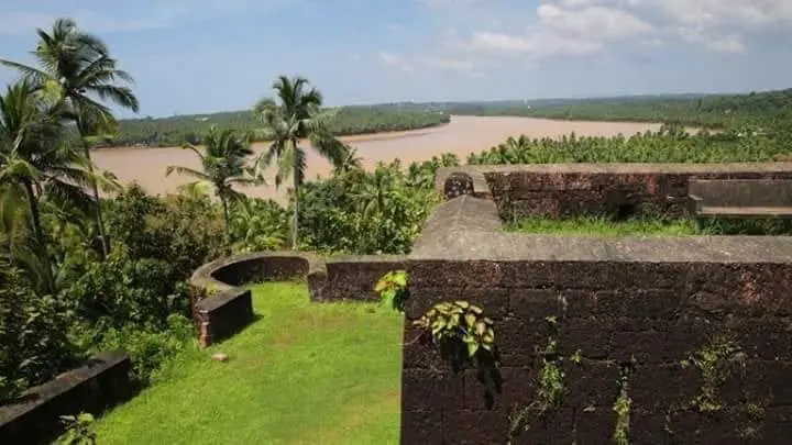
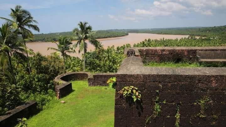
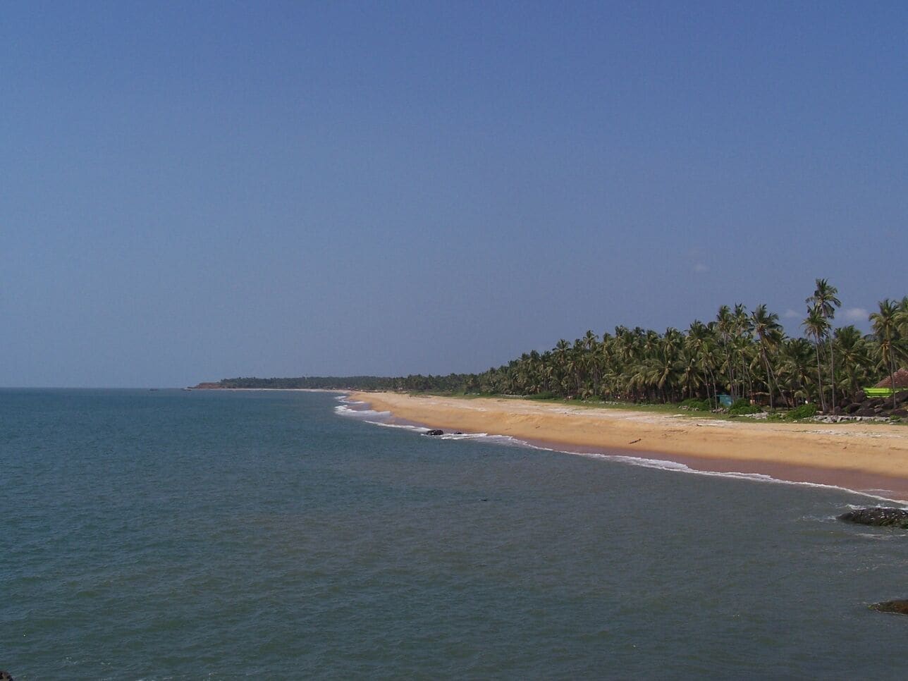
Chandragiri Fort does not overwhelm you with turrets and towers. It works on you slowly. You climb a modest laterite hillock, the ochre-red rock underfoot warm from the sun, and quite suddenly the land falls away on every side. Below, the Chandragiri river — broad and unhurried — swings toward the Arabian Sea, and the two waters meet in a bright confluence framed by coconut groves and sandbars. The fort stands about 150 ft (46 m) above the estuary, and that height is the whole point: this is a ruin you visit less for its walls than for what those walls let you see.
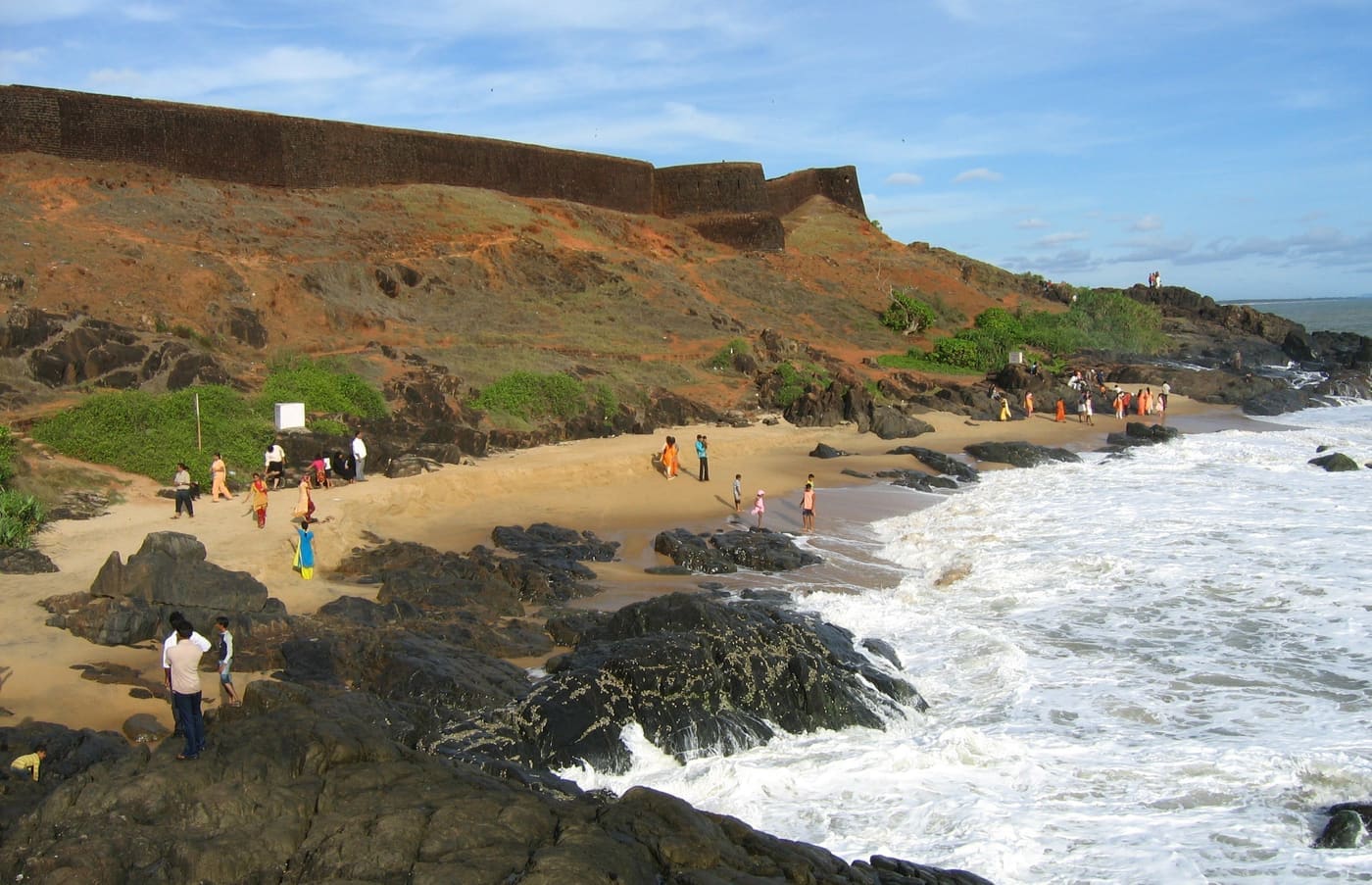
What survives is the outline of a large, roughly square enclosure of hard laterite stone, spread across several acres atop the rise. Local descriptions count eight bastions pierced with embrasures — the old cannon or peeranky holes — angled to command the sea approach and the river bar below. A dry trench once wrapped much of the perimeter, and the remnants of gateways and inner barracks can still be traced by anyone willing to walk slowly and imagine. Time, monsoon and salt air have worn the rest to grassy footings.
The setting has always been strategic rather than scenic. The Chandragiri river is a historic frontier — for centuries a boundary between the Tulu Nadu country to the north and the Kolathunad/Malabar world to the south — and whoever held this bluff held the crossing and the harbour mouth. That is why a fort rose here at all, and why it belongs to a chain of laterite strongholds strung along this coast, the mightiest of them the great Bekal Fort a little to the south, with Hosdurg fort near Kanhangad completing the group.
Today the fort is a quiet, unhurried place, cared for as a protected monument by the Kerala State Department of Archaeology. There is no museum-crowd bustle, no ticketed spectacle competing with the view. Families come to sit on the ramparts in the late afternoon; couples and photographers drift out toward the seaward bastions as the light turns gold. Down at the river you may find country boats and small ferries, and the neighbouring Kizhur area offers gentle backwater boating for those who want to see the fort from the water.
Come in the last hour before sunset and the ruin earns its keep. The estuary silvers, fishing craft cut dark silhouettes across the glare, and the whole west coast seems to tilt toward the sinking sun. Bring water and sensible footwear — the ground is uneven laterite and there is little shade — and give yourself time simply to sit. Chandragiri is a short, easy detour from Bekal or Kasaragod town, and rewards the traveller who treats it as a pause rather than a checklist tick.
Legend & myth
The name Chandragiri translates literally as ‘moon hill’ or ‘moon mountain’ (chandra, moon; giri, hill), and the fort takes its name from the river and locality rather than the reverse. Sources describe the poetic name without attaching a firm, well-documented origin legend to it, so the meaning is best enjoyed simply as an evocative image — a moonlit bluff above a river — rather than treated as a story with historical weight.
History
The deeper history of this spot is a frontier history. The Chandragiri river long served as a natural boundary line — commonly cited as dividing the Tulu Nadu (Tulunad) country to the north from the Kolathunad and Malabar lands to the south. In the late medieval period this borderland fell within the southern reach of the Vijayanagara empire, and the river marked something close to the empire’s frontier zone on this coast, making the crossing and its harbour mouth a place worth controlling.
With the decline of Vijayanagara, the Keladi or Ikkeri Nayakas — who had administered the region on the empire’s behalf — asserted independence and extended their own authority over the coast. The fort itself is most commonly attributed to Shivappa Nayaka (Sivappa Naik) of the Bednore/Ikkeri line and dated to the 17th century, built as part of a wider programme of laterite coastal fortresses in the region. Some accounts place the construction in the mid-to-late 1600s; readers should treat the exact date and attribution as the traditional and widely repeated account rather than an ironclad certainty, as sources are not uniformly precise on the year.
The fort was engineered for coastal defence. Built of hard local laterite, it occupies a hilltop of roughly seven-plus acres, with an inner square enclosure and eight bastions set with embrasures to guard the sea route and river bar. A surrounding trench, gateways on the eastern and western sides, barrack foundations and traces of an underground passage at one corner are all recorded features — the working anatomy of a small garrison fort rather than a palace.
Like much of this coast, Chandragiri changed hands as regional powers rose and fell. Over the centuries control is described as passing through Vijayanagara-era and Nayaka authority to the Mysore rulers Hyder Ali and Tipu Sultan, and finally to the British East India Company as their power spread across Malabar and South Canara. Each transfer reflected the wider contest for the Malabar–Canara seaboard rather than any single dramatic siege remembered here.
In the modern era the fort has passed out of military use and into heritage care. It stands today in a ruined but atmospheric state, protected and maintained by the Kerala State Department of Archaeology. Excavations at the site are reported to have turned up cannonballs of stone and iron, iron implements and pottery — modest but telling evidence of the garrison life once housed on this quiet, sea-facing bluff.
Why visit
The sunset. Chandragiri is widely rated among the finest sunset viewpoints in northern Kerala — the fort’s height above the river mouth gives an unobstructed westward sweep as the sun drops into the Arabian Sea.
The confluence panorama. Few forts offer this exact geography: the broad Chandragiri (Payaswini) river, its estuary and sandbars, the backwaters and the open sea all laid out together from a single laterite terrace.
Authentic, uncrowded ruin. Unlike heavily commercialised sites, Chandragiri stays quiet and unhurried — grassy ramparts, weathered laterite bastions and room to wander at your own pace under a protected-monument calm.
An easy pairing with Bekal. The fort sits in the same laterite-fort family as the far larger Bekal Fort and Hosdurg, so it slots naturally into a Kasaragod–Bekal heritage day rather than demanding a trip of its own.
River and backwater time. Down at the estuary and the neighbouring Kizhur area you can add gentle boating on the Chandragiri backwaters, watching the fort recede on its hill from the water.
Photography and stillness. The warm ochre of the laterite, silhouetted fishing craft on the estuary, and the low golden light make this a rewarding spot for photographers — and a genuinely peaceful place simply to sit.